


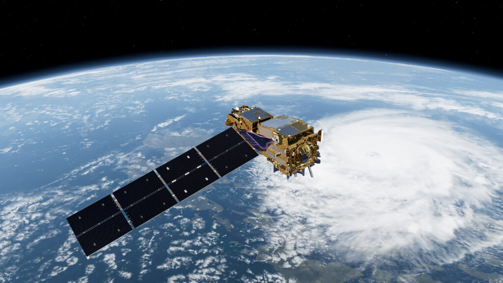
On August 12 late at night, ESA has launched the European MetOp-SG-A1 satellite from its base in French Guiana. The partly Dutch Sentinel-5 instrument onboard is an addition to the already active Sentinel-5p/TROPOMI satellite. SRON has contributed the immersed grating for both and developed the software tools to derive methane and CO data from the observations.
Since 2017, the Dutch TROPOMI instrument onboard the Sentinel-5p satellite has been mapping the entire atmosphere every day for gases such as methane, carbon monoxide and nitrogen dioxide. This has led to large methane leaks being detected on a weekly basis, some of which have a climate impact comparable to that of all traffic in the whole of the Netherlands.
additional orbit
These observations are always done at 1:30pm, because TROPOMI flies in a south-north orbit across the Earth with the Sun permanently shing from behind at a slight angle. The MetOp-SG-A1 satellite, carrying the Sentinel-5 instrument, flies in a different orbit at 9:30am. This provides an extra opportunity every day for cloudless observations and adds a new timeframe to the daily global maps. Some methane plumes are powerful bursts that only last about an hour. Sentinel-5 therefore provides an extra possibility to detect them.
daily global view for decades to come
Versions 2 and 3 of MetOp-SG-A will also be launched at seven-year intervals following last night’s launch. This will ensure that the world keeps a daily global view for decades to come of important pollutants and greenhouse gases. Methane is responsible for a third of global warming because its greenhouse effect is thirty times more powerful than CO2. Carbon monoxide is emitted during forest fires and is an indicator of the amount of CO2 released. Nitrogen dioxide affects nature and is also an indicator of where greenhouse gases are emitted.
weather instruments
In addition to Sentinel-5, MetOp-SG-A1 also contains weather instruments, which KNMI will use to further refine weather forecasts. This applies in particular to storms and associated precipitation, enabling them to warn people even more effectively about extreme weather. Not only on the Dutch mainland, but also in the Caribbean. The Dutch parties involved in the satellite are SRON, KNMI, NSO, TNO and S&T.