


In a Nature publication, SRON researchers teamed up with GHGSat for a global scale survey of methane emissions from more than 150 landfills. They reveal discrepancies between reported inventories and satellite estimates, and also show that satellites can uncover large emitters and pinpoint the exact locations of methane leaks on landfills, thus supporting mitigation efforts.
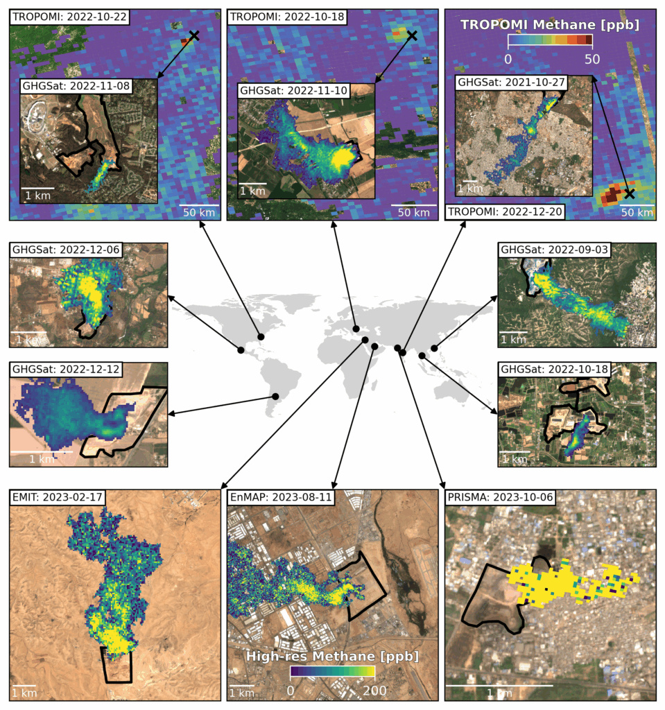
Since its launch in 2017, the Dutch space instrument TROPOMI has been monitoring atmospheric methane concentrations over the entire globe on a daily basis. It has revealed hundreds of methane hotspots. About one third of these are related to urban areas, where landfills are often the most prominent methane emission sources.
notable differences
SRON’s methane team complements urban scale TROPOMI data with high-resolution satellites (GHGSat, EMIT, PRISMA, and EnMAP) that allow to zoom in on cities and estimate facility-scale emission rates. In two papers, in Nature and ES&T, they highlight notable differences between satellite-based emission rates and reported or modeled emission inventories. The 151 landfills observed by GHGSat in the Nature study amount to a total of 2.8 million tons of methane per year, with a climate impact of more than half of the total yearly greenhouse gas emissions of the Netherlands. The newly available large set of satellite data can help improve emission modelling such that the discrepancies can be reduced and can also support mitigation efforts.
exact locations
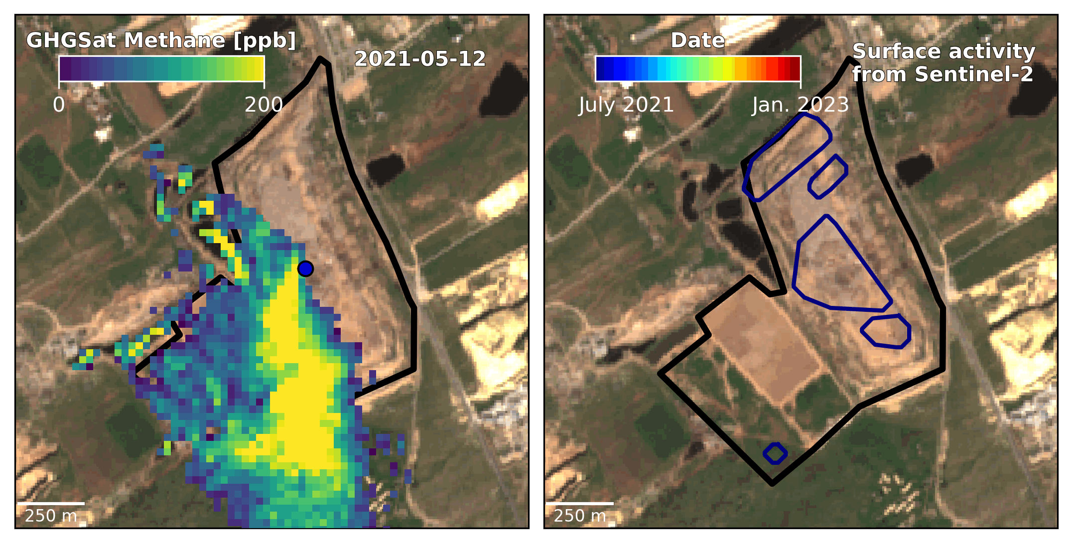
The authors also show how they can pinpoint the exact locations of methane emissions on landfills. Over the course of weeks and months, they see emission plumes moving across the site, in accordance with activity at the landfill seen in visual imagery from the Sentinel-2 satellite. This means that most emissions come from areas where new waste is added and it provides guidance to operators in their emission reduction efforts.
SRON collaborates with GHGSat in the TWOS project funded by the Global Methane Hub to work with local partners in the Global South to use the observations to support emission mitigation.
Publication
Matthieu Dogniaux, Joannes D. Maasakkers, Marianne Girard, Dylan Jervis, Jason McKeever, Berend J. Schuit, Shubham Sharma, Ana Lopez-Noreña, Daniel J. Varon & Ilse Aben, ‘Global satellite survey reveals uncertainty in landfill methane emissions‘, Nature