


| Status | Legacy |
| Launch | 2009 |
| Space organisation | ESA |
| Type | Gravity |
| Orbit | Low-earth orbit (250 km) |
| SRON contribution to | End-to-end closed loop simulator and High-level Processing Facility |
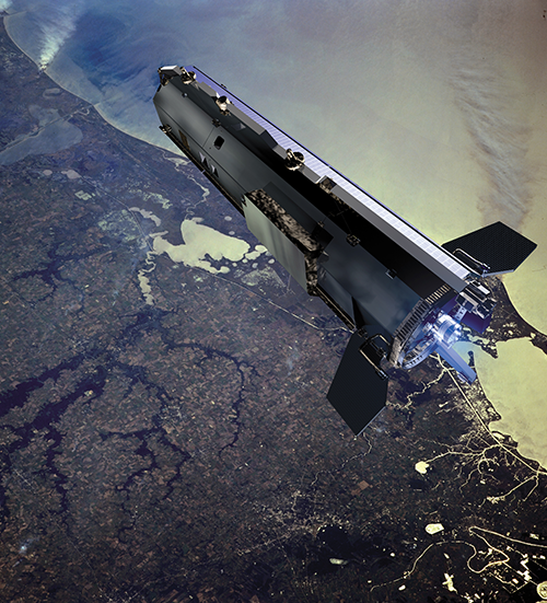
The Earth is round. However, it is not a perfect sphere. Due to high mountain ranges, deep ocean trenches, and internal density variations, gravity is not equally strong everywhere. GOCE mapped the so-called ‘geoid’. This is the imaginary surface of a global, stationary ocean shaped exclusively by gravity.
By comparing other measurements to this geoid, scientists could draw conclusions about the actual situation on Earth. For example, if you subtract the geoid from the actual sea level, you are left with exactly the ‘hills and valleys’ that scientists use to map ocean currents. The GOCE data also aided in mapping melting ice caps and rising sea levels.
GOCE conducted its measurements using a gradiometer, which consisted of three pairs of accelerometers placed fifty centimetres apart. By comparing how the Earth pulls slightly harder or softer on these accelerometers, GOCE mapped the minute ripples in the gravity field.
The satellite flew at an altitude of just 250 kilometres to ‘feel’ the gravity field as accurately as possible. To compensate for the drag from the outer layers of the atmosphere, GOCE featured an aerodynamic design and an end-to-end closed-loop control system. The gradiometer simultaneously served as an aerodynamic drag sensor. It was connected to an ion thruster to compensate for air resistance.
In the early stages of the project, SRON laid the foundation for the end-to-end closed loop simulations. In these, both the control system and the scientific observations were simulated to estimate the satellite’s performance.
In later stages, SRON developed the High-level Processing Facility (HPF) together with the Technical University of Munich and TU Delft. This converts the raw satellite data into usable databases for scientists. The HPF combined the data from the onboard measurement instruments. A GPS receiver continuously tracked whether the satellite accelerated or decelerated in its orbit, which provides insights into the overall flattening of the Earth. SRON also co-developed the algorithms for this process.