



SRON scientists have developed an open-source system called HyperGas that enables users to convert raw hyperspectral satellite observations into greenhouse-gas plume concentrations and emission estimates. Hyperspectral satellites have a high enough resolution to detect and quantify greenhouse gas emissions from individual facilities. By providing a common framework across multiple instruments, the software helps build a consistent and transparent community-supported system for quantifying facility-level emissions.
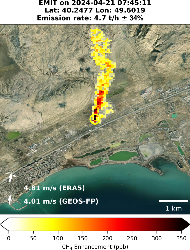
Hyperspectral imaging satellites were originally designed to observe the Earth’s surface, but their high spatial and spectral resolution also enables the detection of plumes of greenhouse gases such as methane and carbon dioxide. HyperGas streamlines analyses across multiple datasets, including observations from EMIT, EnMAP, and PRISMA. It can also be extended to future satellite and airborne missions. The system is already used for the TWOS and MEDUSA projects.
“HyperGas lowers the barrier for researchers and operational users to derive greenhouse-gas emissions from a growing number of hyperspectral missions,” says Xin Zhang (SRON), lead developer of the system.

From radiances to emission rates
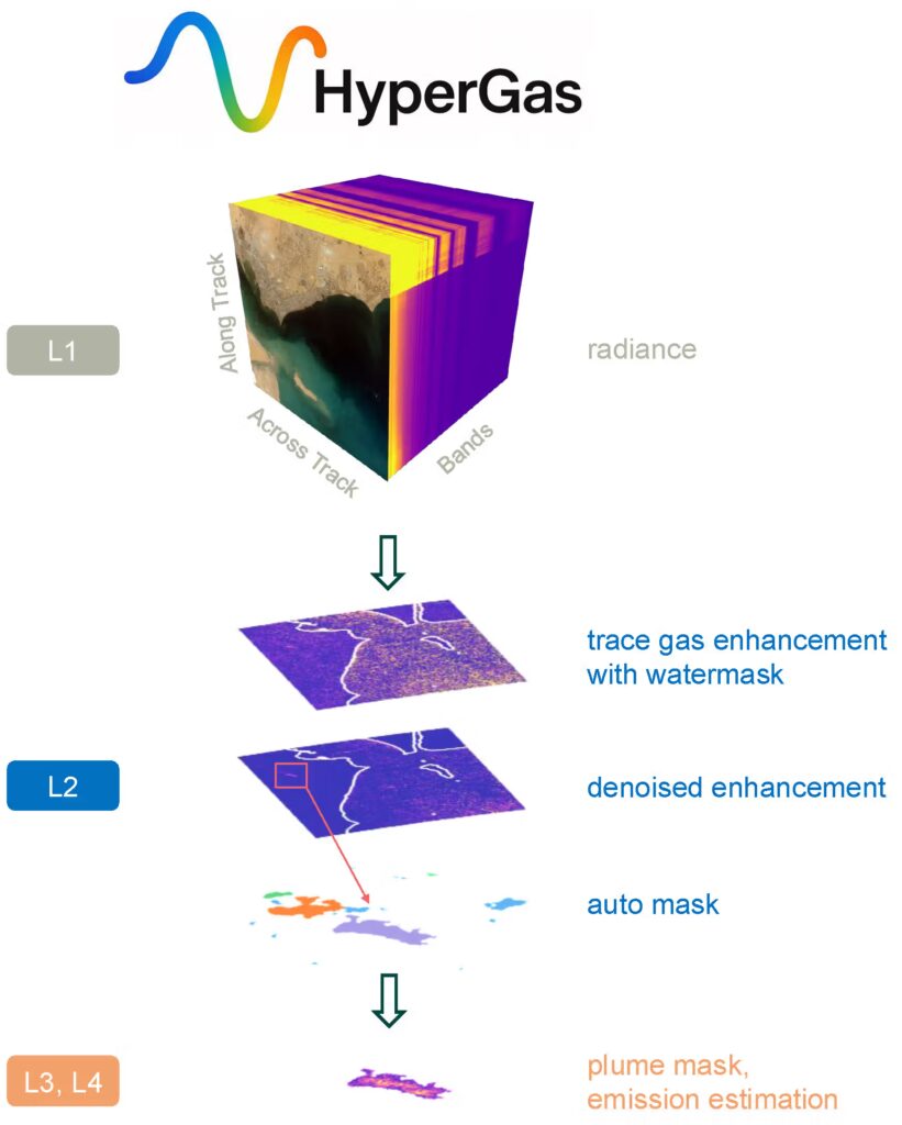
HyperGas provides an end-to-end workflow, taking users from the raw radiance data to plume detection, and emission-rate estimation. The software includes an interactive interface for visualizing greenhouse-gas plumes and identifying emission sources (Fig. 1). HyperGas’s open-source design enables the community to contribute new algorithms and support additional instruments. Emission rate estimates have been validated using controlled releases, where known quantities of gas are released for short durations.
Looking ahead
The SRON team is currently extending HyperGas to process data from commercial satellite parties such as GHGSat for a CAMS service that provides hot-spot methane emissions based on Copernicus Contributing Missions. With new hyperspectral missions planned for the coming years, HyperGas provides a foundation for turning growing volumes of satellite data into actionable information on greenhouse-gas emissions.
Publication
Zhang, X., Maasakkers, J. D., de Jong, T. A., Tol, P., Reuland, F., Brandt, A. R., Kort, E. A., Adams, T. J., and Aben, I.: HyperGas 1.0: a python package for analyzing hyperspectral data for greenhouse gases from retrieval to emission rate quantification, Geosci. Model Dev., 19, 5979–6000, https://doi.org/10.5194/gmd-19-5979-2026, 2026.